Property Record
1025 Bryan Woods Loop, Savannah, GA 31410

NEARBY LISTINGS FOR SALE OR LEASE
-
-
View all Savannah listings for sale on LoopNet.com
Property Detail
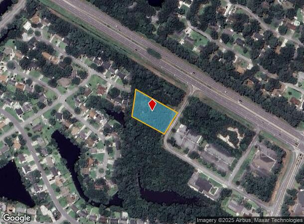
1025 Bryan Woods Loop
Savannah, GA
Islands Bullriv
1011501055
LOT 10 BRYAN WOODS PROFESSIONAL CENTER PH 2 SMB 34S 41 1.05 AC
Industrialgeneral
Chatham
AE
Georgia
45053C0575D
10
2024
1.05 AC
2025
Outer Islands
011114
Savannah
DEMOGRAPHICS near 1025 Bryan Woods Loop
1 Mile
3 Mile
5 Mile
2024 Total Population
2,820
20,929
51,179
2029 Population
2,935
21,483
52,656
Pop Growth 2024-2029
+ 4.08%
+ 2.65%
+ 2.89%
Average Age
42
44
41
2024 Total Households
1,181
8,980
20,537
HH Growth 2024-2029
+ 4.15%
+ 2.78%
+ 3.05%
Median Household Inc
$83,375
$82,344
$68,145
Avg Household Size
2.40
2.30
2.30
2024 Avg HH Vehicles
2.00
2.00
2.00
Median Home Value
$343,142
$340,571
$290,420
Median Year Built
1992
1988
1979
Nearby Places
Map Layers
Map Styles
 Street
 Aerial
- Restaurants
- Banks
- Shops
- Fitness
- Groceries
PUBLIC TRANSPORTATION
AIRPORT
Savannah/Hilton Head International
DRIVE
WALK
Distance
Savannah/Hilton Head International
32 min
16.7 mi
Hilton Head
DRIVE
WALK
Distance
Hilton Head
72 min
44.3 mi
Freight Ports
Georgia Ports - Savannah
DRIVE
WALK
Distance
Georgia Ports - Savannah
27 min
14.0 mi
Nearby Properties
Address
Land Use
TOTAL SIZE
Lot Size
Zoning
Address
Land Use
TOTAL SIZE
Lot Size
Zoning
26,388 SF
27.95 AC
PUD
Address
Land Use
TOTAL SIZE
Lot Size
Zoning
17,664 SF
32.17 AC
PUDM
Address
Land Use
TOTAL SIZE
Lot Size
Zoning
6,192 SF
22.02 AC
PUD
Address
Land Use
TOTAL SIZE
Lot Size
Zoning
8,112 SF
17.89 AC
R1
Address
Land Use
TOTAL SIZE
Lot Size
Zoning
5,760 SF
20.03 AC
R1
Address
Land Use
TOTAL SIZE
Lot Size
Zoning
92,763 SF
32.07 AC
RA
Address
Land Use
TOTAL SIZE
Lot Size
Zoning
29.35 AC
RA-BN
Address
Land Use
TOTAL SIZE
Lot Size
Zoning
42,658 SF
10.13 AC
PBC
Address
Land Use
TOTAL SIZE
Lot Size
Zoning
15,250 SF
10.79 AC
PUDIS
Address
Land Use
TOTAL SIZE
Lot Size
Zoning
13,229 SF
20.64 AC
TB
Address
Land Use
TOTAL SIZE
Lot Size
Zoning
840 SF
51.68 AC
PUDM
Address
Land Use
TOTAL SIZE
Lot Size
Zoning
4,608 SF
6.55 AC
RA
Address
Land Use
TOTAL SIZE
Lot Size
Zoning
90,003 SF
1.80 AC
Address
Land Use
TOTAL SIZE
Lot Size
Zoning
41,353 SF
5.23 AC
PBC
Address
Land Use
TOTAL SIZE
Lot Size
Zoning
31,522 SF
6.03 AC
PR3-16
Address
Land Use
TOTAL SIZE
Lot Size
Zoning
29,242 SF
5.38 AC
TB
Address
Land Use
TOTAL SIZE
Lot Size
Zoning
14,601 SF
4.15 AC
RA-BN
Address
Land Use
TOTAL SIZE
Lot Size
Zoning
17,842 SF
20 AC
RA
Address
Land Use
TOTAL SIZE
Lot Size
Zoning
2,400 SF
6.43 AC
PBC
Address
Land Use
TOTAL SIZE
Lot Size
Zoning
1,731 SF
1.33 AC
R1
Address
Land Use
TOTAL SIZE
Lot Size
Zoning
97,321 SF
13.56 AC
PBC
Address
Land Use
TOTAL SIZE
Lot Size
Zoning
39,903 SF
2.67 AC
PSC
Address
Land Use
TOTAL SIZE
Lot Size
Zoning
2,876 SF
7.41 AC
TB/CM/EO
Address
Land Use
TOTAL SIZE
Lot Size
Zoning
120.17 AC
PUDM
Address
Land Use
TOTAL SIZE
Lot Size
Zoning
36,834 SF
3.55 AC
PSC
Address
Land Use
TOTAL SIZE
Lot Size
Zoning
1,400 SF
90 AC
R1
Address
Land Use
TOTAL SIZE
Lot Size
Zoning
2,601 SF
3.86 AC
C1
Address
Land Use
TOTAL SIZE
Lot Size
Zoning
1,407 SF
150.38 AC
RA
Address
Land Use
TOTAL SIZE
Lot Size
Zoning
26,325 SF
4.97 AC
RA
Address
Land Use
TOTAL SIZE
Lot Size
Zoning
7,296 SF
2.53 AC
PBC
The World's #1 Commercial Real Estate Marketplace
Connect with us
© 2026 CoStar Group
The information above has been obtained from sources believed reliable. While we do not doubt its accuracy we have not verified it and make no guarantee, warranty or representation about it. It is your responsibility to independently confirm its accuracy and completeness. Any projections, opinions, assumptions, or estimates used are for example only and do not represent the current or future performance of the property. The value of this transaction to you depends on tax and other factors which should be evaluated by your tax, financial, and legal advisors. You and your advisors should conduct a careful, independent investigation of the property to determine to your satisfaction the suitability of the property for your needs.